 Clickable Maps
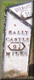 Ballycastle Town, Ballycastle Forest
Ballycastle Golf Club
Bonamargy Friary
Ballycastle Marina
Ballycastle Beach
(1)Glentaisie – Glen of Princess Taisie
(2)Glenshesk – Glen of the Sedges/Reeds
Knocklayde Mountain
North
Botanists, geologists, bird watchers take the ferry to Rathlin Island. If you’re a keen deep sea diver or angler and like a challenge visit some of the one hundred shipwrecks in the surrounding area. Looking for a more scenic route to Scotland then board the ferry to the Mull of Kintyre.
West – The Causeway Coast
The first port of call upon venturing west along Whitepark Road (B15) will be Kinbane Castle & Headland with spectacular views of Carrickamanon Rock, Rathlin Island, Fairhead, Islay and the Mull of Kintyre. Further along you can pull into Portaneevy Viewpoint for a picnic and see Carrickarede Rope Bridge and Sheep Island before stopping in Ballintoy village for a pint, continue on to enjoy a stroll along Whitepark Bay and visit the world’s smallest chapel in Portbradden. Continue along Whitepark Road and turn right onto the B146 where Dunseverick Harbour will be busy with holiday makers and Dunseverick Castle stands proudly on a crag, a little further is the world renowned Giant’s Causeway & Benbane Head leading to Dunseverick. Travel on to the quaint village of Bushmills on the Giant’s Causeway to Bushmills Railway to the village made most famous by the Bushmills Whisky Distillery where samples are free at the end of a tour. The coast road winds it’s way round to the spectacular ruins of Dunluce Castle and the White Rocks before ending at Portrush.
East – The Glens of Antrim
From Ballycastle Diamond go up Castle street and turn left at the top of the hill into Glentaisie Drive where you shall see an excellent side view of Glentaisie. At the next junction turn right up the hill and then left down the hill at the next junction. This road takes you up Glentaisie, turn left at the end of the road stopping at the next junction to look around the old round tower at Armoy. The turn left and follow the road down Glenshesk back into Ballycastle. Upon entering the town limits turn right a the Sheskburn garage onto the Cushendall Road (A2) and turn left onto Carrickmore Road passing the beach. Turn left at Maguire’s Strand Caravan Park to discover Marconi’s Cottage were you can park and walk over Fairhead into Murlough Bay. Alternatively turn right at Maguire’s Strand Caravan Park follow Carrickmore Road and rejoin the Cushendall Road (A2) to enter the village of Ballyvoy, in the center of which there is junction beside the public house allowing for alternative routes to Cushendun/Cushendall. Turning left onto the coast road will take you to Fairhead car park and Loughs, Murlough Bay and then onto Torr Head, Tornamona Cashel, Dunloughan Farm Museum and Castle Carra before entering the village of Cushendun.
If however you choose the inland route it will take you past Watertop Farm and onto Ballypatrick Forest that adjoins Loughareema (Vanishing Lake) after which you can turn left onto the Cushendun Road (B92) taking you down into Glendun (Glen of the River Dun/Brown Glen) to the picturesque Cushendun village. Stop in Cushendun and enjoy the peacefulness before turning around and traveling up Glendun alongside the river to pass by Craigagh Churchyard, the Gloonan Stone and Saint Patrick’s Well to the forest edge with a gate to the Mass Rock then continue onward under the spectacular Glendun Viaduct. Drive right up Glendun, not forgetting to stop regularly to appreciate the spectacular views back down the glen. When you reach the top of the glen turn left at the crossroads and travel down Glenann (Glen of the Proverb/Blue Glen) alongside Glenaan River past Oisín’s Grave (3800BC) until you turn right onto the A2 in Glencorp (Glen of the dead) before entering the village of Cushendall. Upon entering Cushendall your will arrive at a crossroads that is over-shadowed by the Curfew Tower on the left, straight ahead will take you to Layd Church or turn right and follow the coast road through Glenballyeamon (Glen of Edwardstown) and under the Red Bay Arch and Castle ruins to enter the Queen of the Glens, Glenariff (Glen of the Plough/Arable Glen). Glenariff is the largest of the glens with a forest park, featuring picturesque waterfalls and several walks, and Waterfoot village at it’s base. After the Red Bay Arch look right into the cliff face and you will see the cave dwellings, one of which is called the Nanny’s cave and was inhabited by a woman called Anne Murray who supported herself by knitting, spinning and selling a drop of poteen. Another of the caves was used as a smith’s forge and a third was used as a school. Follow the A43 road up Glenariff stopping only to look back and understand why it is known as the ‘Queen of the Glens’ before continuing passing Altnagowna waterfall. Also known as Grey Mare’s Tail this is the tallest waterfall in Glenariff and is truly a magnificent sight. Next stop along the coast road is Carnlough village nestled in Glencloy (Glen of the Stone Ditches/Dykes) and finally you will enter Glenarm village in Glenarm (Glen of the Army).
